Skip all navigation and jump to content Jump to site navigation Jump to section navigation.
region to select NASA home page region to select NASA GSFC home page
NASA Logo - Goddard Space Flight Center + Visit NASA.gov region to select the NASA home page region to select the NASA GSFC home page
Aerosol Robotic Network (AERONET)
AEROSOL OPTICAL DEPTH AEROSOL INVERSIONS SOLAR FLUX OCEAN COLOR Maritime Aerosol Network
For receiving updates on AERONET - subscribe to the mailing list by sending an email to aeronet-join@lists.nasa.gov

+Home
+ AERONET Home


Section Header Image
AEROSOL/FLUX NETWORKS
COLLABORATORS
DATA
NASA PROJECTS
PUBLICATIONS
STAFF
SYSTEM DESCRIPTION
 
AERONET DATA ACCESS
 
AERONET Site Lists (V3)

+ Text Format

+ Google Earth Format

+ All Lists

 
MARITIME AEROSOL NETWORK (MAN)
 
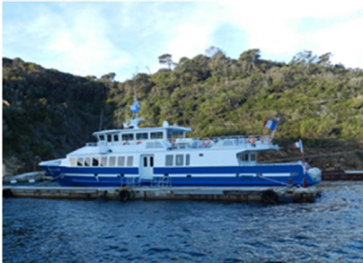
2013 Local ferry Cruise
 

Local ferry

The data series include 66 points acquired by François Dulac (LSCE, France) on 1st August 2013 during a local ferry transect between Levant Island and Toulon on the French Mediterranean coast (Bay of Hyeres, East of the Gulf of Lion). Those measurements are part of the Chemistry-Aerosol Mediterranean Experiment/ Secondary Aerosol Formation in the Mediterranean (ChArMEX/SAFMED) campaign performed in the framework of the MISTRALS (Mediterranean Integrated Studies at Regional and Local Scales) program.

 
DATA


CRUISE PHOTOS


PUBLICATIONS


  + Privacy Policy and Important Notices NASA Curator: Ilya Slutsker
NASA Official: Pawan Gupta
Generated: 19/04/2024