|
|
 |
AERONET Site Information Database
Site Index
|
|
|
Image
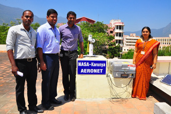
1 - The aeronet team of Karunya University |
| Image
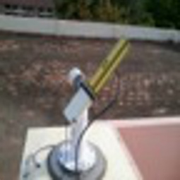
2 - view of the sun photometer. |
|
Image 1
|
Image 2
|
|
|
Site Coordinates and Elevation:
|
- Latitude: 10.93530° North
- Longitude: 76.74410° East
- Elevation: 478.0 Meters
|
|
Site
Description:
|
- Karunya University is located in the lap of western ghats and is 26 km away from Coimbatore city, India. The city is located on the banks of Noyyal river, which drains into the Cauvery river. The instrument is located on the roof top of Civil Engineering building of Karunya University.
|
|
Principal
Investigator(s)
Information:
|
- Pawan Gupta
- E-mail: pawan.gupta@nasa.gov
-
Pawan Gupta
NASA Goddard Space Flight Center
Code 618. Bldg.33. Rm.G412
Greenbelt, MD. 20771
Tel: 301-614-6658
Email: pawan.gupta@nasa.gov
- Elena Lind
- E-mail: elena.lind@nasa.gov
-
Elena Lind
NASA Goddard Space Flight Center
Code 618. Bldg.33. Rm.G414
Greenbelt, MD 20771
Tel: 301-614-6629
Email: elena.lind@nasa.gov
AND
- P. Brema
- E-mail:
AND
- Sneha Gautam
- E-mail: snehagautam@karunya.edu
Dr. Sneha Gautam
Associate Professor
Dept. of Civil Engineering
Karunya Institute of Technology and Sciences
Email: snehagautam@karunya.edu
|
|
Site
Manager(s) Information:
|
- A Joe Paulson
- Email: joe@karunya.edu
-
A Joe Paulson
Dy Chief Engineer
Construction & Maintenance
Karunya University
Coimbatore - 641 114 India.
Phone - 94878 46467
Email: joe@karunya.edu
|
|
Responsible
Institution(s):
|
-
AERONET Project
NASA Goddard Space Flight Center
https://aeronet.gsfc.nasa.gov
Karunya University, Coimbatore, India
www.karunya.edu
|
|
Email Amy Scully
for content and picture updates.
Additional Photographs and Images
| CAPTION | IMAGE |
|---|
|
Image 3 - Vice Chancellor of Karunya University inaugurating the aeronet facility
| 
|
Last Generated: 15 MAY 2024
|