|
|
 |
AERONET Site Information Database
Site Index
|
|
|
Image
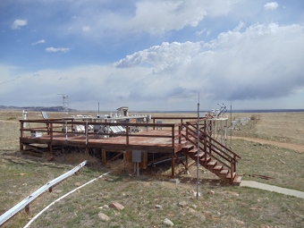
1 - View of the instrument deck at Table Mountain, CO. |
| Image
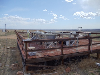
2 - View of the instrument. |
|
Image 1
|
Image 2
|
|
|
Site Coordinates and Elevation:
|
- Latitude: 40.12500° North
- Longitude: 105.23700° West
- Elevation: 1689.0 Meters
|
|
Site
Description:
|
- The CIMEL instrument is located on the south edge of the Department of Commerce's Table Mountain location, north of Boulder, Colorado. Table Mountain is truly a misnomer because it is a plateau, which is situated approximately five miles east of the Front Range of the Rocky Mountains. The terrain is flat and treeless and is covered by native grasses. The only occlusion to the horizon is the Rocky Mtns, with the maximum occlusion of approximately 5 degrees just north of due west of the site.
|
|
Principal
Investigator(s)
Information:
|
- Scott Stierle
- E-mail: scott.stierle@noaa.gov
Scott Stierle
NOAA Antarctic UV Monitoring Program
NOAA-EPA Brewer UV-ozone Monitoring Network (NEUBrew)
NOAA/GMD/GRAD Central UV Calibration Facility
NOAA GMD Room 2D-102A
325 Broadway
Boulder, CO. 80305
303 497 6620 Ph
303 497 6546 FAX
Email: scott.stierle@noaa.gov
|
|
Site
Manager(s) Information:
|
- Scott Stierle
- Email: scott.stierle@noaa.gov
-
Scott Stierle
NOAA Antarctic UV Monitoring Program
NOAA-EPA Brewer UV-ozone Monitoring Network (NEUBrew)
NOAA/GMD/GRAD Central UV Calibration Facility
NOAA GMD Room 2D-102A
325 Broadway
Boulder, CO. 80305
303 497 6620 Ph
303 497 6546 FAX
Email: scott.stierle@noaa.gov
|
|
Responsible
Institution(s):
|
|
|
Email Amy Scully
for content and picture updates.
Additional Photographs and Images
| CAPTION | IMAGE |
|---|
|
Image 3 - View of the instrument and the Flatiron Mountains in the distance.
| 
|
Last Generated: 15 MAY 2024
|