|
|
 |
AERONET Site Information Database
Site Index
|
|
|
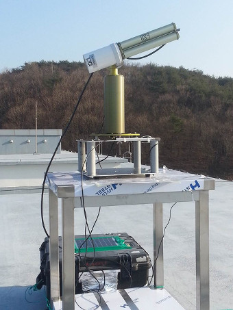
Image
1 - View of the sunphotometer. |
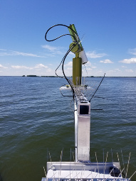
| Image
2 - view of the sunphotometer |
|
Image 1
|
Image 2
|
|
|
Site Coordinates and Elevation:
|
- Latitude: 44.59633° North
- Longitude: 87.95120° West
- Elevation: 175.9 Meters
|
|
Site
Description:
|
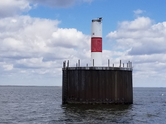
- The equipment will be installed on the Angle light station. This site is a coast guoard navigation aid located in the center shipping channel in the bay of Green Bay, which drains into Lake Michigan. The nearest city is Green Bay, with a population of approximately 110,000, is an industrial area, particularly noted for paper product production.
|
|
Principal
Investigator(s)
Information:
|
- Nima Pahlevan
- E-mail: nima.pahlevan@nasa.gov
Nima Pahlevan
Science Systems and Applications, Inc.
NASA Goddard Space Flight Center / Code 619
8800 Greenbelt Road, Greenbelt, MD 20771
Bldg. 32, Rm S036N
Tel: 301-614-6684
Email: nima.pahlevan@nasa.gov
|
|
Site
Manager(s) Information:
|
- Sarah Bartlett
- Email: SBartlett@newwater.us
-
Sarah Bartlett
c/o NEW Water
2231 N Quincy St,
Green Bay, WI 54302
Email: SBartlett@newwater.us
Phone: 920 438-1088
|
|
Responsible
Institution(s):
|
-
NEW Water
2231 N Quincy St,
Green Bay, WI 54302
http://newwater.us/
University of Wisconsin-Madison
Aquatic Sciences Center
1975 Willow Drive, 2nd Floor
Madison, WI 53706-1177
https://www.aqua.wisc.edu/home/
Wisconsin Department of Natural Resources
Water Quality Bureau, Monitoring section
101 S. Webster St.
Madison, WI 53707
https://dnr.wi.gov/topic/surfacewater/monitoring.html
NASA Goddard Space Flight Center / Code 619
8800 Greenbelt Road, Greenbelt, MD 20771
https://www.nasa.gov/goddard
|
|
Email Amy Scully
for content and picture updates.
Additional Photographs and Images
| CAPTION | IMAGE |
|---|
|
Image 3 - view of the sunphotometer
| 
|
|
Image 4 - view of the sunphotometer
| 
|
Last Generated: 19 APR 2024
|