Skip all navigation and jump to content Jump to site navigation Jump to section navigation.
region to select NASA home page region to select NASA GSFC home page
NASA Logo - Goddard Space Flight Center + Visit NASA.gov region to select the NASA home page region to select the NASA GSFC home page
Aerosol Robotic Network (AERONET)
AEROSOL OPTICAL DEPTH AEROSOL INVERSIONS SOLAR FLUX OCEAN COLOR Maritime Aerosol Network
For receiving updates on AERONET - subscribe to the mailing list by sending an email to aeronet-join@lists.nasa.gov

+Home
+ AERONET Home


Section Header Image
AEROSOL/FLUX NETWORKS
COLLABORATORS
DATA
NASA PROJECTS
PUBLICATIONS
STAFF
SYSTEM DESCRIPTION
 
AERONET DATA ACCESS
 
AERONET Site Lists (V3)

+ Text Format

+ Google Earth Format

+ All Lists

 
MARITIME AEROSOL NETWORK (MAN)
 
2011 FRV Tom Marshall Cruise
 

FRV Tom Marshall

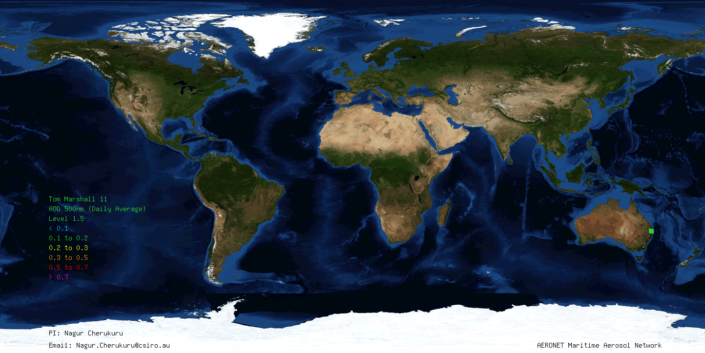
Aerosol optical thickness data was collected during three trips in Moreton Bay. These field trip were arranged in response to the 2011 Queensland Floods. The main purpose of the aerosol optical thickness data collected during this cruise is to improve the atmospheric correction in the ocean colour data processing. Those cruises are a part of ongoing wider environmental earth observation research activity undertaken at the Commonwealth Scientific and Industrial Research Organization (CSIRO) with the support of Wealth from Oceans, National Flagship program, Australia.

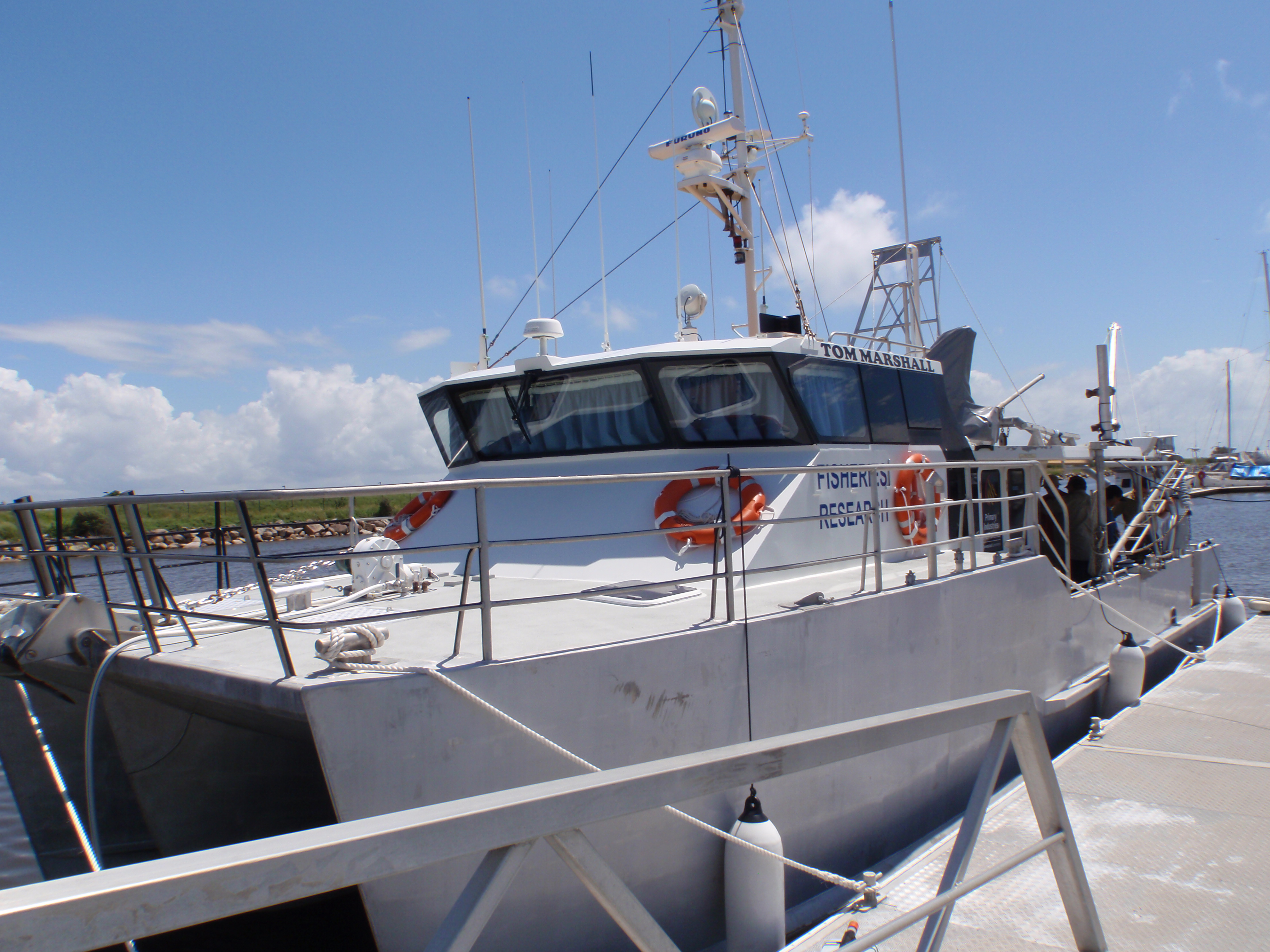
Data was collected onboard FRV Tom Marshall operated by Primary Industries and Fisheries, Queensland Government. Fifty-nine measurement series spanning 8 measurement days were acquired.

Dr. Nagur Cherukuru from CSIRO was a Principal Investigator for aerosol optical depth measurements and operated a sunphotometer onboard.

 
DATA


CRUISE PHOTOS


PUBLICATIONS


  + Privacy Policy and Important Notices NASA Curator: Ilya Slutsker
NASA Official: Pawan Gupta
Generated: 04/20/2024