|
|
 |
AERONET Site Information Database
Site Index
|
|
|
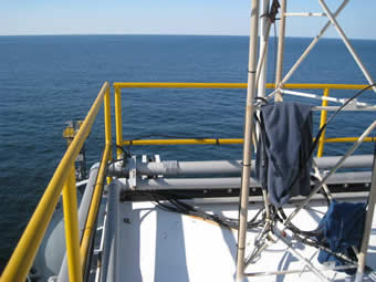
Image
1 - View of the platform |
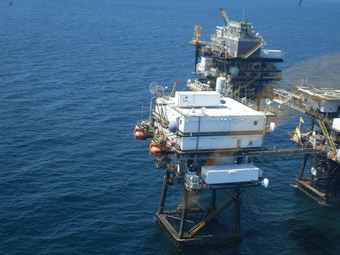
| Image
2 - View of the platform |
|
Image 1
|
Image 2
|
|
|
Site Coordinates and Elevation:
|
- Latitude: 28.86667° North
- Longitude: 90.48333° West
- Elevation: 33.6 Meters
|
|
Site
Description:
|
- Site located on the roof of ST52B Quarters Platform. This is part of a triple oil rig platform in which the other two structures make up the productions platforms.
|
|
Principal
Investigator(s)
Information:
|
- Sherwin Ladner
- E-mail: Sherwin.Ladner@nrlssc.navy.mil
-
Sherwin Ladner (Oceanographer)
Bio-Optical Physical Processes & Remote Sensing Section, Code 7331
1009 Balch Blvd.
Stennis Space Center, MS 39529-5004
Tel: 228.688.5754
Email: Sherwin.Ladner@nrlssc.navy.mil
|
|
Site
Manager(s) Information:
|
- Sherwin Ladner
- Email: Sherwin.Ladner@nrlssc.navy.mil
-
Sherwin Ladner (Oceanographer)
Bio-Optical Physical Processes & Remote Sensing Section, Code 7331
1009 Balch Blvd.
Stennis Space Center, MS 39529-5004
Tel: 228.688.5754
Email: Sherwin.Ladner@nrlssc.navy.mil
|
|
Responsible
Institution(s):
|
-
Naval Research Laboratory (Bob Arnone POC)and NOAA Integrated Program Office, Robert.Arnone@nrlssc.navy.mil
Natalie N. Eaves, Research Administrator, High Performance Computing Collaboratory (HPCC), Mississippi State University, #2 Research Blvd., Starkville, MS 39759
Mail Stop 9627, natalie@hpc.msstate.edu, Phone: 662.325.3670, Fax: 662.325.7692
|
|
Email Amy Scully
for content and picture updates.
Additional Photographs and Images
| CAPTION | IMAGE |
|---|
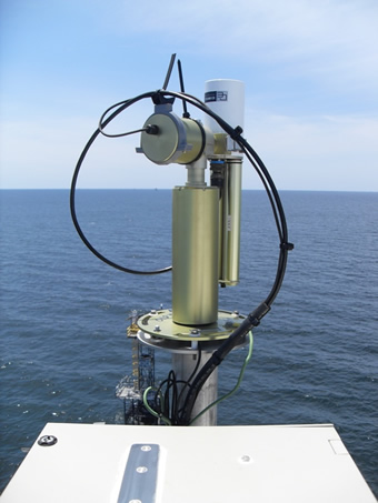
|
Image 3 - View of instrument
| 
|
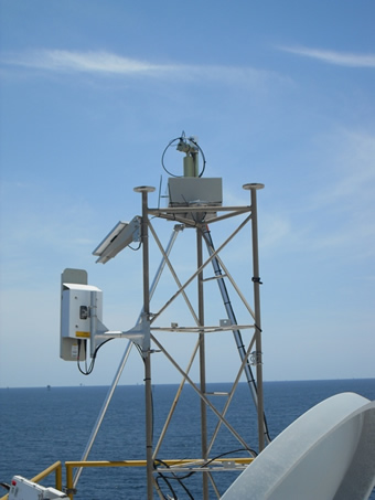
|
Image 4 - View of the instrument to the SW
| 
|
Last Generated: 28 MAY 2024
|