|
|
 |
AERONET Site Information Database
Site Index
|
|
|
Image
1 - |
| Image
2 - |
|
Image 1
|
Image 2
|
|
|
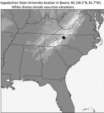
Site Coordinates and Elevation:
|
- Latitude: 36.21460° North
- Longitude: 81.69380° West
- Elevation: 1080.0 Meters
|
|
Site
Description:
|
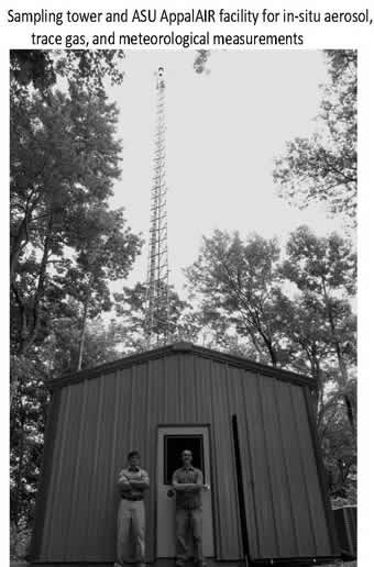
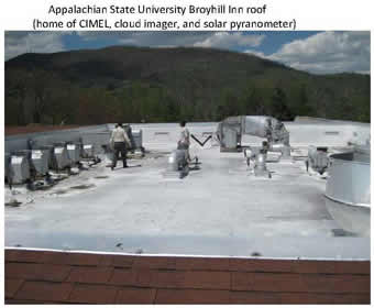
- The CIMEL will be mounted on a flat platform (along with a Kipp and Zonan CM22 solar pyranometer and Yankee Scientific TSI-440 All-Sky Imager) and will be located on the roof of the Broyhill Inn and Convention Center. The roof represents the highest location on the Appalachian State University campus in Boone, NC. Boone is a small town located 150km northeast of Asheville, NC and 160km northwest of Charlotte, NC. Boone's mountain location in a region lacking significant industrial sources allows for aerosol measurements which are representative of the Southern Appalachian mountain region.
|
|
Principal
Investigator(s)
Information:
|
- James Sherman
- E-mail: shermanjp@appstate.edu
James Sherman
Department of Physics and Astronomy
Appalachian State University
525 Rivers St
Garwood Hall Room 231
Boone, NC 28608
Cell: (724) 664-9077
Email: shermanjp@appstate.edu
|
|
Site
Manager(s) Information:
|
- James Sherman
- Email: shermanjp@appstate.edu
-
James Sherman
Department of Physics and Astronomy
Appalachian State University
525 Rivers St
Garwood Hall Room 231
Boone, NC 28608
Cell: (724) 664-9077
Email: shermanjp@appstate.edu
|
|
Responsible
Institution(s):
|
-
College of Arts and Natural Sciences, Appalachian State University
www.cas.appstate.edu
|
|
Email Amy Scully
for content and picture updates.
Additional Photographs and Images
Last Generated: 10 MAY 2024
|