|
|
 |
AERONET Site Information Database
Armilla (Armilla, Spain)
Site Index
|
|
|
Image
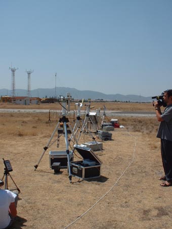
1 - A view of the instrument site. � |
| Image
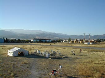
2 - Another view of the instrument site. |
|
Image 1
|
Image 2
|
|
|
Site Coordinates and Elevation:
|
- Latitude: 37.13426° North
- Longitude: 3.63152° West
- Elevation: 687.0 Meters
|
|
Site
Description:
|
- In the summer of 2002, from July 7th to 21st, the VELETA2002 (eValuation of the Effects of eLevation and aErosols on the ultravioleT rAdiation) field campaign was conducted at the Sierra Nevada Massif, close to Granada in South-Eastern Spain, an area with a dry continental climate. This field campaign was conducted to obtain experimental data on the elevation effects on the solar ultraviolet irradiance, and to monitor different atmospheric parameters, including vertical ozone content, aerosol properties, and UV irradiance data. Different UV-radiometers, UV-VIS-NIR spectroradiometers, Cimel sun-photometers and other type of instrumentation, including portable meteorological weather stations and two LIDAR systems, were installed at both slopes of Sierra Nevada Massif at six different field stations covering from 0 meters a.m.s.l to 3400 meters. a.m.s.l at the top of the Veleta Peak.
|
|
Principal
Investigator(s)
Information:
|
- Victoria E. Cachorro Revilla
- E-mail:
|
|
Site
Manager(s) Information:
|
|
|
Responsible
Institution(s):
|
|
|
Email Amy Scully
for content and picture updates.
Additional Photographs and Images
| CAPTION | IMAGE |
|---|
|
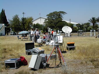
Image 3 - Another view of the instrument site. The Armilla site (630 m) measurements were taken for instrument intercomparison and reference monitoring stations. Armilla is located close the city of Granada. ��
| 
|
Last Generated: 10 MAY 2024
|