|
|
 |
AERONET Site Information Database
Site Index
|
|
|
Image
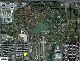
1 - view of the sunphotometer. |
| Image
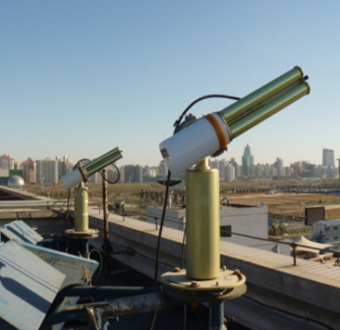
2 - view of the sunphotometer. |
|
Image 1
|
Image 2
|
|
|
Site Coordinates and Elevation:
|
- Latitude: 40.00480° North
- Longitude: 116.37860° East
- Elevation: 59.0 Meters
|
|
Site
Description:
|
- The Beijing_RADI site is located in the north part of Beijing between the 4th and 5th city ring roads. The main land-use types around this site are roads and residential areas, while Beijing Olympic Forest Park, covering 6.8 km2 with vegetation rate of nearly 90%, is located less than 1 km to the northeast of the site.
|
|
Principal
Investigator(s)
Information:
|
- Zhengqiang Li
- E-mail: lizq@radi.ac.cn�
Dr. Zhengqiang LI
Institute of Remote Sensing and Digital Earth
Chinese Academy of Sciences
No.20 Datun Road
Chaoyang District
P.O.Box 9718
Beijing 100101, P.R.China
Tel: +86 10 6485 7437
Fax: +86 10 6480 6225
E-mail: lizq@radi.ac.cn
|
|
Site
Manager(s) Information:
|
- Kaitao LI
- Email: likt@radi.ac.cn
-
Kaitao LI
Institute of Remote Sensing and Digital Earth
Chinese Academy of Sciences
No.20 Datun Road
Chaoyang District
P.O.Box 9718
Beijing 100101, P.R.China
Tel: +86 10 6485 7437
Fax: +86 10 6480 6225
E-mail: likt@radi.ac.cn
|
|
Responsible
Institution(s):
|
|
|
Email Amy Scully
for content and picture updates.
Last Generated: 10 MAY 2024
|