|
|
 |
AERONET Site Information Database
Birkenes (Birkenes, Norway)
Site Index
|
|
|
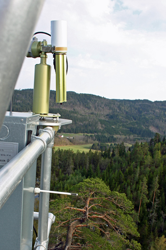
Image
1 - View of the photometer on top of the container. |
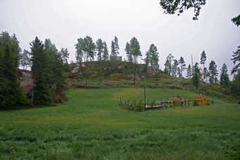
| Image
2 - Location of the container on top of a ridge (view from the North), near the old air pollution monitoring site.� |
|
Image 1
|
Image 2
|
|
|
Site Coordinates and Elevation:
|
- Latitude: 58.38845° North
- Longitude: 8.25231° East
- Elevation: 230.0 Meters
|
|
Site
Description:
|
- The Birkenes atmospheric research station (58 23N, 8 15E, 230 m asl.) is run by the Norwegian Institute for Air research (NILU). Birkenes is a joint supersite for EMEP and GAW and situated in the southern part of Norway. The site is located in an undulating terrain in a clearing (original site) and on an elevation (new).�Birkenes has been in operation since 1971 and has been one of the keystone sites in Europe to study long-range transported air pollution. The long-term monitoring programme at Birkenes consists of meteorology, main inorganic components, heavy metals, persistent organic pollutants, ozone, VOC and particles. In 2009 the site has been expanded with a measurement container for aerosol and climate gas measurements.�
|
|
Principal
Investigator(s)
Information:
|
- Kerstin Stebel
- E-mail: kst@nilu.no�
Kerstin Stebel
Atmosphere and Climate Change Department
The Climate and Environmental Research Institute NILU
PO Box 100, 2027 Kjeller
Norway
Phone: +47 63 89 81 75
E-mail: kst@nilu.no
|
|
Site
Manager(s) Information:
|
- Wenche Aas
- Email: waa@nilu.no
-
Wenche Aas
Atmosphere and Climate Change Department
Norwegian Institute for Air Research (NILU)
P.box 100, 2027 Kjeller
Norway
Phone: +47 63 89 81 60
E-mail: waa@nilu.no
|
|
Responsible
Institution(s):
|
|
|
Email Amy Scully
for content and picture updates.
Additional Photographs and Images
| CAPTION | IMAGE |
|---|
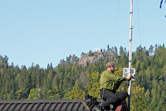
|
Image 3 - Location of the container on top of a ridge (view from the South).�
| 
|
Last Generated: 10 MAY 2024
|