|
|
 |
AERONET Site Information Database
Site Index
|
|
|
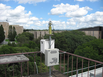
Image
1 - View of the sunphotometer. |
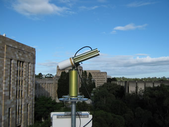
| Image
2 - View of the sunphotometer. |
|
Image 1
|
Image 2
|
|
|
Site Coordinates and Elevation:
|
- Latitude: 27.49708° South
- Longitude: 153.01361° East
- Elevation: 42.0 Meters
|
|
Site
Description:
|
- Mounted on roof of office block on University campus with clear sky view.�3 km from CBD of Brisbane city (population of approx 2 million).
|
|
Principal
Investigator(s)
Information:
|
- Michael Tobe
- E-mail: m.tobe@uq.edu.au
Michael Tobe
Lab, Field & Tech. Services Manager
Geography, Planning and Environmental Management
Room 422, Chamberlain Building, St Lucia
The University of Queensland 4072
Phone: + 61 7 336-56513
Email: m.tobe@uq.edu.au
|
|
Site
Manager(s) Information:
|
- Michael Tobe
- Email: m.tobe@uq.edu.au
-
Michael Tobe
Lab, Field & Tech. Services Manager
Geography, Planning and Environmental Management
Room 422, Chamberlain Building, St Lucia
The University of Queensland 4072
Phone: + 61 7 336-56513
Email: m.tobe@uq.edu.au
|
|
Responsible
Institution(s):
|
-
Queensland Department of Environment and Resource Management (www.derm.qld.gov.au)
University of Queensland (www.uq.edu.au)
|
|
Email Amy Scully
for content and picture updates.
Last Generated: 10 MAY 2024
|