|
|
 |
AERONET Site Information Database
Site Index
|
|
|
Image
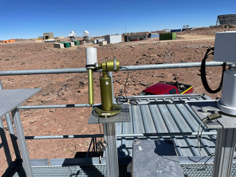
1 - CIMEL #1169 photometer measuring at Chajnantor site in April 2022. |
| Image
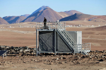
2 - Chajnantor site |
|
Image 1
|
Image 2
|
|
|
Site Coordinates and Elevation:
|
- Latitude: 22.95931° South
- Longitude: 67.78612° West
- Elevation: 5149.0 Meters
|
|
Site
Description:
|
- Chajnantor is a high-altitude plateau over the Andean mountains, about 40 km east of San Pedro de Atacama. There are several astronomical projects (including the ALMA Observatory) on the plateau. Dust is the main source of aerosols but the diesel generator from nearby astronomical projects may also be a source of black carbon on the plateau. The photometer has been set up at an atmospheric station aimed at monitoring the extreme solar radiation in the area.
|
|
Principal
Investigator(s)
Information:
|
- Raul R. Cordero
- E-mail: raul.cordero@usach.cl
Dr. Raul R. Cordero
Departamento de Física
Universidad de Santiago de Chile
Rosario Norte 399, Las Condes
Santiago Chile
Tel: +56 9 97352030
Email: raul.cordero@usach.cl
|
|
Site
Manager(s) Information:
|
|
|
Responsible
Institution(s):
|
-
University of Santiago, Chile (USACH)
www.usach.cl www.antarctica.cl
|
|
Email Amy Scully
for content and picture updates.
Last Generated: 10 MAY 2024
|