|
|
 |
Back to Map
|
Coordinates:
38.80745° N,
76.07257° W
Elevation: 15.0 m
|
Site Description
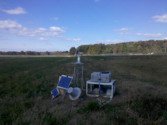
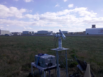
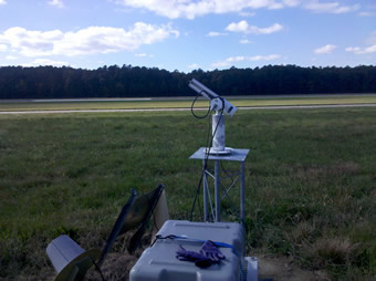
The Easton Airport sun photometer is installed on a 4 foot tower 0.62 km NW of the main airport runway located on the northern outskirts of the town of Easton, MD.
|
| Contact Information |
|
Principal Investigator(s):
|
- Martha Anderson
- E-mail: Martha.Anderson@ars.usda.gov�
Dr. Martha Anderson
USDA-ARS-HRSL
10300 Baltimore Ave.
Beltsville, MD 20705
Voice: (301) 504-6616
Fax: (301) 504-8931
Email: Martha.Anderson@ars.usda.gov
|
|
Site Manager(s):
|
- Wayne Dulaney
- Email: Wayne.Dulaney@ars.usda.gov
-
Wayne Dulaney
USDA-ARS-HRSL
10300 Baltimore Ave.
Beltsville, MD 20705
Voice: (301) 504-6076
Fax: (301) 504-8931
Email: Wayne.Dulaney@ars.usda.gov
|
|
Responsible
Institution(s):
|
-
USDA-ARS-Hydrology and Remote Sensing Laboratory
10300 Baltimore Ave.
Beltsville, MD 20705
www.ars.usda.gov/ba/anri/hrsl
|
|
Email Amy Scully
for content and picture updates.
Last Generated: 18 MAY 2024
|