|
|
 |
AERONET Site Information Database
Elandsfontein (Elandsfontein, South Africa)
Site Index
|
|
|
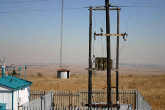
Image
1 - Elandsfontein, South Africa |
| Image
2 - Elandsfontein, South Africa |
|
Image 1
|
Image 2
|
|
|
Site Coordinates and Elevation:
|
- Latitude: 26.24534° South
- Longitude: 29.41757° East
- Elevation: 1740.0 Meters
|
|
Site
Description:
|
- Elandsfontein monitoring site, is situated in central Mpumalanga, 25km east of Kriel and Matla Power Stations, 38km south of Duvha Power Station and 50km south-south-east of Witbank. About 70% of the Highveld area where Elandsfontein is located, is covered by grassland and the rest is utilised for agricultural, urban and industrial activities. The area houses rich coal reserves and the Mpumalanga Highveld is home to eight coal-fired power stations, which are in close proximity to one another resulting in very high emission densities in the region. The area is also home to heavy industry, located within small towns as well as petrochemical industries in Sasolburg and Secunda.
|
|
Principal
Investigator(s)
Information:
|
- Stuart Piketh
- E-mail: stuart.piketh@nwu.ac.za
Prof Stuart J. Piketh
School of Geo- and Spatial Science
Unit for Env. Sc. and Management
North-West University
Potchefstroom
Tel: +27 18 299 1582
Cell: +27 82 806 3026
Fax: +27 18 299 1496
e-mail: stuart.piketh@nwu.ac.za
|
|
Site
Manager(s) Information:
|
- Thomas Bigala
- Email: thomas@crg.wits.ac.za
-
Thomas Bigala
Climatology Research Group
University of the Witwatersrand
P/Bag 3
Braamfontein 2050
Johannesburg, SOUTH AFRICA
Phone: 27 11 717 6536
Fax: 27 11 717 6535
E-mail: thomas@crg.wits.ac.za
|
|
Responsible
Institution(s):
|
-
Climatology Research Group
University of the Witwatersrand
www.crg.wits.ac.za
|
|
Email Amy Scully
for content and picture updates.
Last Generated: 10 MAY 2024
|


