|
|
 |
AERONET Site Information Database
Site Index
|
|
|
Image
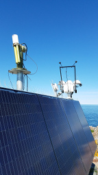
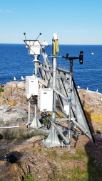
1 - View of the sunphotometer |
| Image
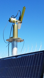
2 - View of the sunphotometer |
|
Image 1
|
Image 2
|
|
|
Site Coordinates and Elevation:
|
- Latitude: 46.72080° North
- Longitude: 87.41200° West
- Elevation: 183.0 Meters
|
|
Site
Description:
|
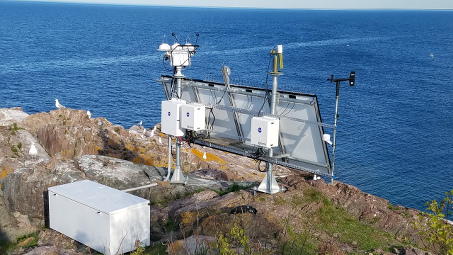
- The instrument site is located at Granite Island, a 10,077 square meter (2.49 acre) island located in Lake Superior. The nearest land point is approximately 10 km (6 miles) and Marquette, Michigan is the closest city 19 km (12 miles) away. The island is largely unaffected by land influences but can be affected if winds are out of the SW sector, but its not particularly common.�
|
|
Principal
Investigator(s)
Information:
|
- Pawan Gupta
- E-mail: pawan.gupta@nasa.gov
-
Pawan Gupta
NASA Goddard Space Flight Center
Code 618. Bldg.33. Rm.G412
Greenbelt, MD. 20771
Tel: 301-614-6658
Email: pawan.gupta@nasa.gov
- Elena Lind
- E-mail: elena.lind@nasa.gov
-
Elena Lind
NASA Goddard Space Flight Center
Code 618. Bldg.33. Rm.G414
Greenbelt, MD 20771
Tel: 301-614-6629
Email: elena.lind@nasa.gov
|
|
Site
Manager(s) Information:
|
- Bryan Fabbri
- Email: bryan.e.fabbri@nasa.gov
-
Bryan Fabbri
Science Systems and Applications, Inc.
One Enterprise Parkway, Suite 200
Hampton, VA, USA 23666
phone: (757) 951 1639
fax: (757) 951-1902
AND
- Fred Denn
- Email: frederick.m.denn@nasa.gov
-
Fred Denn
Science Systems and Applications, Inc.
One Enterprise Parkway Suite 200
Hampton, VA 23666
Tel: 757- 951-1636
Email: frederick.m.denn@nasa.gov
|
|
Responsible
Institution(s):
|
|
|
Email Amy Scully
for content and picture updates.
Additional Photographs and Images
| CAPTION | IMAGE |
|---|
|
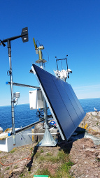
Image 3 - View of the sunphotometer
| 
|
|
Image 4 - View of the sunphotometer
| 
|
|
Image 5 - View of the sunphotometer
| 
|
Last Generated: 10 MAY 2024
|