|
|
 |
AERONET Site Information Database
Helgoland (Helgoland Island, Germany)
Site Index
|
|
|
Image
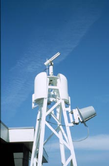
1 - A view of the sunphotometer on a mast with a remote controlled cover for weather protection.� |
| Image
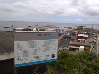
2 - A view of the sun photometer on a cliff overlooking the harbor. |
|
Image 1
|
Image 2
|
|
|
Site Coordinates and Elevation:
|
- Latitude: 54.17786° North
- Longitude: 7.88736° East
- Elevation: 33.0 Meters
|
|
Site
Description:
|
- This site is located on a platform overlooking the water on Helgoland Island, Germany. Helgoland is a very small island in the middle of the German Bight nearly 35 miles far from land. The German Bight is part of the North Sea. The island has rocky cliffs of red-colored sandstone with an altitude of 60 meters. In former times it was a sea-fortress but now it has tourism, a little fishery, a coast guard base, pilots, sea-rescue, and the home of a well-known institute for biological and zoological research.(http://www.helgoland.de)
|
|
Principal
Investigator(s)
Information:
|
- Wolfgang Cordes
- E-mail: wolfgang.cordes@hzg.de�
Wolfgang Cordes
Helmholtz-Zentrum Geesthacht
Max-Planck-Str.1
D-21502 Geesthacht, Germany
Phone: 494152 871591
E-mail: wolfgang.cordes@hzg.de
|
|
Site
Manager(s) Information:
|
- Wolfgang Cordes
- Email: wolfgang.cordes@hzg.de�
-
Wolfgang Cordes
Helmholtz-Zentrum Geesthacht
Max-Planck-Str.1
D-21502 Geesthacht, Germany
Phone: 494152 871591
E-mail: wolfgang.cordes@hzg.de
|
|
Responsible
Institution(s):
|
-
Helmholtz-Zentrum Geesthacht, Institute for Coastal Research, D-21502 Geesthacht, Germany
http://www.hzg.de
|
|
Email Amy Scully
for content and picture updates.
Last Generated: 10 MAY 2024
|