|
|
 |
AERONET Site Information Database
Henties_Bay (Henties Bay, Namibia)
Site Index
|
|
|
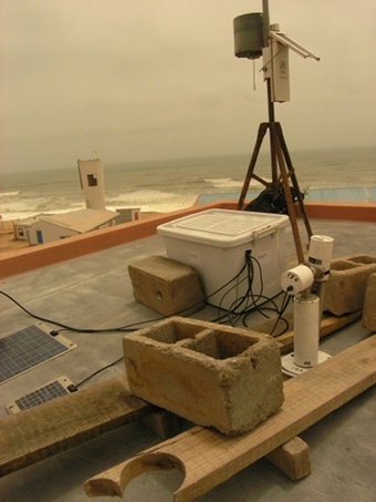
Image
1 - view of the sunphotometer |
| Image
2 - view of the sunphotometer |
|
Image 1
|
Image 2
|
|
|
Site Coordinates and Elevation:
|
- Latitude: 22.09506° South
- Longitude: 14.25974° East
- Elevation: 20.0 Meters
|
|
Site
Description:
|
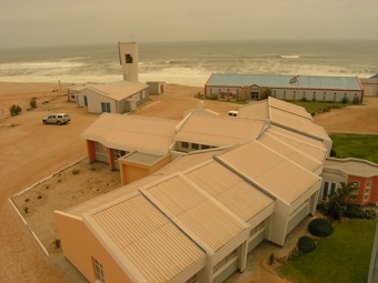
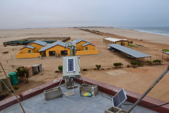
- The instrument is located on the roof of a tower attached to one of the buildings at the University of Namibia Marine and Coastal Resources Research Center. This is approximately one kilometer North�of the fishing village of Henties Bay. Aerosol sources include the Atlantic ocean, which is 150 meters away to the West and the Namib Desert which comes right up to the beach, and extends inland to the East across Namibia and Botswana. There are large sand dunes between the towns of Swakopmund, 70km to the South, and Luderitz, about 500km to the South of Henties Bay. There are numerous salt pans scattered�around the area, with commercial salt mining activities about 20 kilometers North of Henties Bay. Etosha Pan is approximately 350 kilometers to the North East of the site. The area is also suspected to be affected by biomass burning in Angola during the winter season.
|
|
Principal
Investigator(s)
Information:
|
- Stuart Piketh
- E-mail: stuart.piketh@nwu.ac.za
Prof Stuart J. Piketh
School of Geo- and Spatial Science
Unit for Env. Sc. and Management
North-West University
Potchefstroom
Tel: +27 18 299 1582
Cell: +27 82 806 3026
Fax: +27 18 299 1496
e-mail: stuart.piketh@nwu.ac.za
AND
- Paola Formenti
- E-mail: paola.formenti@lisa.ipsl.fr
Paola Formenti
CNRS Researcher, PhD
Laboratoire Interuniversitaire des Systèmes Atmosphériques (LISA, UMR 7583)
61, Av. du Générale de Gaulle
94010 Créteil FRANCE
tel: +33 (1) 82 39 20 49
fax: +33(0)1 45 17 15 64
Email: paola.formenti@lisa.ipsl.fr
www.lisa.u-pec.fr/~formenti/
|
|
Site
Manager(s) Information:
|
- Andreas Namwoonde
- Email: anamwoonde@unam.na
-
Andreas Namwoonde
UNAM Marine and Coastal Resources Research Center
Henties Bay, Namibia
Tel: +264 64 502 612
Email: anamwoonde@unam.na
AND
- Edosa Omoregie
- Email: omoregie@unam.na
-
Prof. Edosa Omoregie
UNAM Marine and Coastal Resources Research
Center
Henties Bay, Namibia
Tel: +264 64 502 610
Email:
|
|
Responsible
Institution(s):
|
-
Climatology Research Group, University of the Witwatersrand,
Johannesburg
http://crg.wits.ac.za/
Laboratoire Interuniversitaire des Systèmes Atmosphériques
(LISA, UMR 7583)
|
|
Email Amy Scully
for content and picture updates.
Additional Photographs and Images
| CAPTION | IMAGE |
|---|
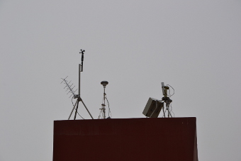
|
Image 3 - view of the sunphotometer
| 
|
|
Image 4 - view of the sunphotometer
| 
|
|
Image 5 - view of the sunphotometer
| 
|
Last Generated: 10 MAY 2024
|


