|
|
 |
AERONET Site Information Database
Howland (Howland, Maine)
Site Index
|
|
|
Image
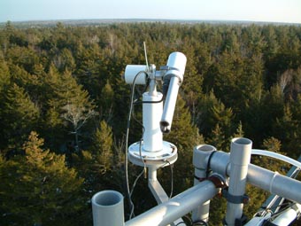
1 - A view of the sun photometer on the meteorological tower. |
| Image
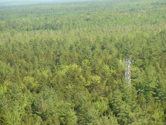
2 - A view of the 25 m walk-up meteorological tower (lower left corner) within the forest. |
|
Image 1
|
Image 2
|
|
|
Site Coordinates and Elevation:
|
- Latitude: 45.20410° North
- Longitude: 68.74020° West
- Elevation: 120.0 Meters
|
|
Site
Description:
|
- Established in 1987, the Howland Forest research site is located about 35 miles north of Bangor at 45 12' N, 68 44' W. The site lies within a commercial, mature conifer/transitional hardwood forest owned by International Paper. More information on Howland Forest Ecosystem Research is available at http://www.envirophys.umaine.edu/forest/.
|
|
Principal
Investigator(s)
Information:
|
- Pawan Gupta
- E-mail: pawan.gupta@nasa.gov
-
Pawan Gupta
NASA Goddard Space Flight Center
Code 618. Bldg.33. Rm.G412
Greenbelt, MD. 20771
Tel: 301-614-6658
Email: pawan.gupta@nasa.gov
- Elena Lind
- E-mail: elena.lind@nasa.gov
-
Elena Lind
NASA Goddard Space Flight Center
Code 618. Bldg.33. Rm.G414
Greenbelt, MD 20771
Tel: 301-614-6629
Email: elena.lind@nasa.gov
|
|
Site
Manager(s) Information:
|
- John Lee
- Email: jtlee@maine.edu
-
John Lee
Environmental Physics Group
University of Maine
201 Environmental Sciences Labs
Orono, ME 04469 USA
Phone: 207-581-2930
E-mail: jtlee@maine.edu
|
|
Responsible
Institution(s):
|
|
|
Email Amy Scully
for content and picture updates.
Last Generated: 9 MAY 2024
|