|
|
 |
AERONET Site Information Database
Site Index
|
|
|
Image
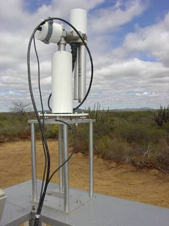
1 - Aeronet Detailed view over SONDA module. |
| Image
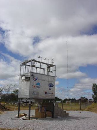
2 - Sonda Module West side. |
|
Image 1
|
Image 2
|
|
|
Site Coordinates and Elevation:
|
- Latitude: 9.06910° South
- Longitude: 40.32011° West
- Elevation: 381.0 Meters
|
|
Site
Description:
|
- Petrolina station is located in the Brazilian Northeast semi-arid region, where could be found one of the greatest incidences of solar radiation in the country. That region also have long drought periods in contrast to seldom heavy rain fall strongly affected by El Niño La Niña systems. The site is retired from urban areas on EMBRAPA-Agricultural Research Center for semi arid climate. There is also a network of 7 meteorological stations radio linked around the radiometric station run by local site manager.�
|
|
Principal
Investigator(s)
Information:
|
- Enio B. Pereira
- E-mail: enio.pereira@inpe.br
Dr. Enio B. Pereira
INPE - Instituto Nacional de Pesquisas Espaciais
Av dos Astronautas 1758
Sao Jose Dos Campos SP Brasil
12.201-970
Phone: + 55 12 3945-6741
E-mail: enio.pereira@inpe.br
|
|
Site
Manager(s) Information:
|
- Magna Soelma Bezerra de Moura
- Email: magna@cpatsa.embrapa.br
-
Dr. Magna Soelma Bezerra de Moura
Embrapa Semi-árido
Address: Rod. BR428 km 152 Zona Rural
Petrolina PE Brasil
56302-970
Phone: + 55 87 3862-1711 or 3862-2980
E-mail: magna@cpatsa.embrapa.br
|
|
Responsible
Institution(s):
|
-
MCT: Ministério da Ciência e Tecnologia www.mct.gov.br
FINEP: Financiadora de Estudos e Projetos www.finep.gov.br
INPE. Instituto Nacional de Pesquisas Espaciais www.inpe.br
CPTEC: Centro de Previsão do Tempo e Estudos Climáticos www.cptec.inpe.br
DMA: Divisão de Meio Ambiente
LIM: Laboratório de Instrumentação Meteorológica
|
|
Email Amy Scully
for content and picture updates.
Additional Photographs and Images
| CAPTION | IMAGE |
|---|
|
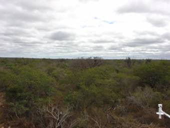
Image 3 - Surrounding area, North view.
| 
|
|
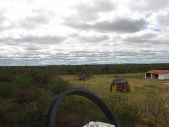
Image 4 - Surrounding area, East view.
| 
|
Last Generated: 10 MAY 2024
|