|
|
 |
AERONET Site Information Database
Site Index
|
|
|
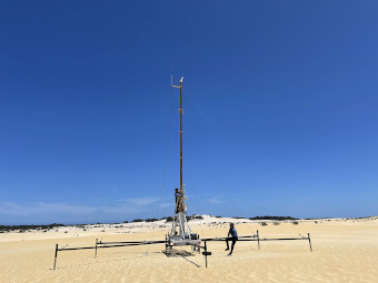
Image
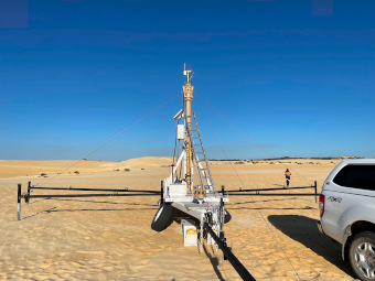
1 - view of the sunphotometer |
| Image
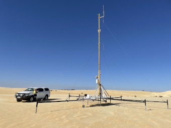
2 - view of the sunphotometer |
|
Image 1
|
Image 2
|
|
|
Site Coordinates and Elevation:
|
- Latitude: 30.58361° South
- Longitude: 115.15500° East
- Elevation: 38.0 Meters
|
|
Site
Description:
|
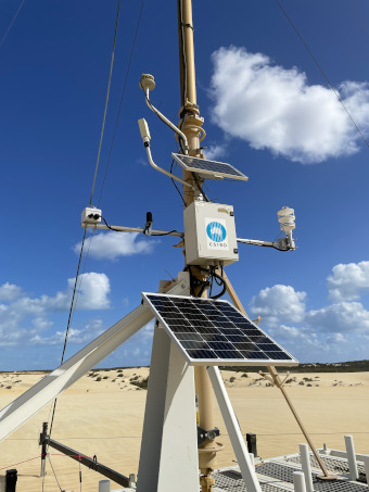
- 12 band CE-318 mounted on top of a 10 metre collapsible mast, mounted on a mobile custom trailer. Site is located in the sand dunes of the Nambung National Park ("The Pinnacles"). Access is restricted to either by on foot or via arrangement with the National Park Rangers. Sand on the surface varies from iron-oxide kaolinite to quartz-calcite in mineralogy and colour from yellow to white. Potential aerosols from ocean (5 km to the west) and dust from sand storms.
|
|
Principal
Investigator(s)
Information:
|
- Ian Lau
- E-mail: ian.lau@csiro.au
Ian Lau
CSIRO Mineral Resources
26 Dick Perry Avenue
Kensington, Western Australia
Australia. (Post code) 6151
Phone is +61 86436 8646
Email: ian.lau@csiro.au
|
|
Co-Investigator(s)
Information
|
- David Barker
- E-mail: david.barker@csiro.au
David Barker
CSIRO Environment
107-121 Station Street
Aspendale, Victoria,
Australia (postcode) 3195
Ph: +61-3-92394450
Email: david.barker@csiro.au
|
|
Site
Manager(s) Information:
|
- Ian Lau
- Email: ian.lau@csiro.au
-
Ian Lau
CSIRO Mineral Resources
26 Dick Perry Avenue
Kensington, Western Australia
Australia. (Post code) 6151
Phone is +61 86436 8646
Email: ian.lau@csiro.au
|
|
Responsible
Institution(s):
|
-
CSIRO Centre for Earth Observation
https://research.csiro.au/cceo/
|
|
Email Amy Scully
for content and picture updates.
Additional Photographs and Images
| CAPTION | IMAGE |
|---|
|
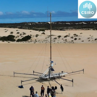
Image 3 - view of the sunphotometer
| 
|
|
Image 4 - view of the sunphotometer
| 
|
|
Image 5 - view of the sunphotometer
| 
|
Last Generated: 10 MAY 2024
|