|
|
 |
AERONET Site Information Database
Pitres (Pitres, Spain)
Site Index
|
|
|
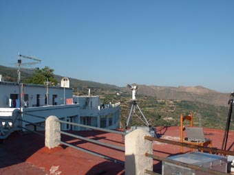
Image
1 - A view of the instrument site. |
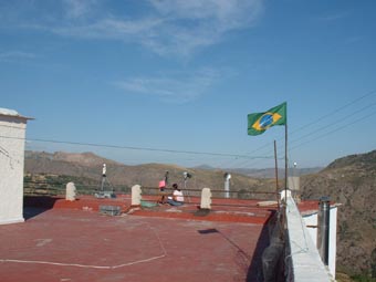
| Image
2 - Another view of the instrument site. |
|
Image 1
|
Image 2
|
|
|
Site Coordinates and Elevation:
|
- Latitude: 36.93578° North
- Longitude: 3.32608° West
- Elevation: 1246.0 Meters
|
|
Site
Description:
|
- In the summer of 2002, from July 7th to 21st, the VELETA2002 (eValuation of the Effects of eLevation and aErosols on the ultravioleT rAdiation) field campaign was conducted at the Sierra Nevada Massif, close to Granada in South-Eastern Spain, an area with a dry continental climate. This field campaign was conducted to obtain experimental data on the elevation effects on the solar ultraviolet irradiance, and to monitor different atmospheric parameters, including vertical ozone content, aerosol properties, and UV irradiance data. Different UV-radiometers, UV-VIS-NIR spectroradiometers, Cimel sun-photometers and other type of instrumentation, including portable meteorological weather stations and two LIDAR systems, were installed at both slopes of Sierra Nevada Massif at six different field stations covering from 0 meters a.m.s.l to 3400 meters. a.m.s.l at the top of the Veleta Peak.
|
|
Principal
Investigator(s)
Information:
|
- Victoria E. Cachorro Revilla
- E-mail:
|
|
Site
Manager(s) Information:
|
|
|
Responsible
Institution(s):
|
|
|
Email Amy Scully
for content and picture updates.
Additional Photographs and Images
| CAPTION | IMAGE |
|---|
|
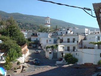
Image 3 - Another view of the Allpujarra region. Motril and Pitres are located in the South slope of Sierra Nevada Massif face to Mediterranean Sea. Pitres (1252 m. altitude) is located in the Alpujarra area, and Motril at sea level, which has a typical tropical climate. The region of mountain villages known as Las Alpujarras lies on the southern flanks of the Sierra Nevada with breathtaking valleys and gorges which run down towards the Mediterranean coast.
| 
|
|
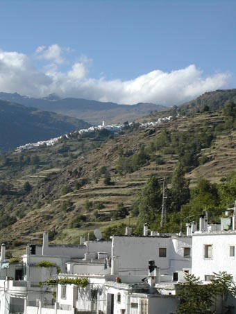
Image 4 - Another view of the Allpujarra region. The Alpujarra is famous for its mini ecology system watered by the melting snow from the mountains of the Sierra Nevada. The terraced lands that you see are always a shade of green due to the constant supply of snowmelt.
| 
|
Last Generated: 10 MAY 2024
|