|
|
 |
AERONET Site Information Database
Upington (Upington, Zambia)
Site Index
|
|
|
Image
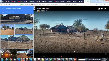
1 - Kalahari Monate Lodge, Upington |
| Image
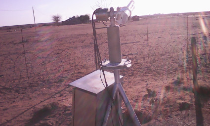
2 - Sunphotometer |
|
Image 1
|
Image 2
|
|
|
Site Coordinates and Elevation:
|
- Latitude: 28.37900° South
- Longitude: 21.15600° East
- Elevation: 865.0 Meters
|
|
Site
Description:
|
- Upington is located at the shore of Orange River. It has high temperature in summer ranging between 34 and 36 degree C and low in winter between -7 to -2o C. The driest month is July while the wettest month is March with just about 37 mm of rainfall (SAWS). It is the sunniest location on the planet for three months of the year (NOAA).The instrument is set up at Kalahari Monate Lodge on R360 about 12.5 Km to Upington. The site is an open land with few trees. The instrument is mounted on a tripod stand. Backward trajectory analysis (HYSPLIT) shows high aerosol loading comes through long range transport of smoke and dust aerosols (CALIPSO) from two major pathways; Indian Ocean through Mozambique, Zambia and Namibia before getting to Upington and secondly over the Atlantic Ocean. Secondly, aerosols are being transported over the Indian Ocean towards Australia as shown by forward trajectory analysis. These long range transport of smoke and dust aerosols over Upington can be attributed to the westerly baroclinic disturbances (Piketh et al., 1999; Tyson et al., 1996).
|
|
Principal
Investigator(s)
Information:
|
- Pawan Gupta
- E-mail: pawan.gupta@nasa.gov
-
Pawan Gupta
NASA Goddard Space Flight Center
Code 618. Bldg.33. Rm.G412
Greenbelt, MD. 20771
Tel: 301-614-6658
Email: pawan.gupta@nasa.gov
- Elena Lind
- E-mail: elena.lind@nasa.gov
-
Elena Lind
NASA Goddard Space Flight Center
Code 618. Bldg.33. Rm.G414
Greenbelt, MD 20771
Tel: 301-614-6629
Email: elena.lind@nasa.gov
AND
- Stuart Piketh
- E-mail: stuart.piketh@nwu.ac.za
Prof Stuart J. Piketh
School of Geo- and Spatial Science
Unit for Env. Sc. and Management
North-West University
Potchefstroom
Tel: +27 18 299 1582
Cell: +27 82 806 3026
Fax: +27 18 299 1496
e-mail: stuart.piketh@nwu.ac.za
|
|
Site
Manager(s) Information:
|
- Joseph Adesina
- Email: joseph.adesina@nwu.ac.za
-
Dr Joseph Adesina
School for Geo and Spatial Science
Unit for Environmental Science and Management
North-West University (Potchefstroom Campus)
Tel: 0730824149
Email: joseph.adesina@nwu.ac.za
|
|
Responsible
Institution(s):
|
|
|
Email Amy Scully
for content and picture updates.
Additional Photographs and Images
| CAPTION | IMAGE |
|---|
|
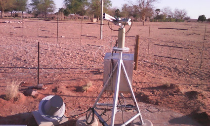
Image 3 - Suphotometer with the GOES antenna
| 
|
Last Generated: 10 MAY 2024
|