|
|
 |
Back to Map
|
Coordinates:
43.68389° N,
7.32889° E
Elevation: 130.0 m
|
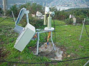
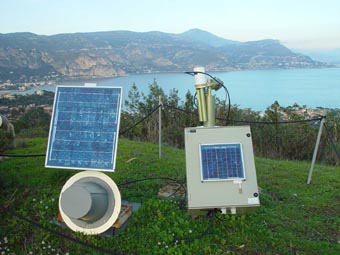
Site Description
This instrument site is located on the site of the Cap Ferrat National Navy semaphore, between the bays of Villefranche and Baulieu.
|
| Contact Information |
|
Principal Investigator(s):
|
- David Antoine
- E-mail: antoine@obs-vlfr.fr
David Antoine
Laboratoire d'Oceanographie de Villefranche (LOV)
Quai de La Darse, BP 8
06238 Villefranche sur Mer Cedex - FRANCE
Phone: ++33 (0)4 93-76-37-23
E-mail: antoine@obs-vlfr.fr
|
|
Site Manager(s):
|
- Vincenzo Vellucci
- Email: enzo@obs-vlfr.fr
-
Vincenzo Vellucci
Laboratoire d'Oceanographie de Villefranche (LOV)
Quai de La Darse, BP 8
06238 Villefranche sur Mer Cedex - FRANCE
tel.: +33 (0)4 93-76-37-08
fax : +33 (0)4 93-76-37-39
Email: enzo@obs-vlfr.fr
|
|
Responsible
Institution(s):
|
|
|
Email Amy Scully
for content and picture updates.
Last Generated: 18 MAY 2024
|