|
|
 |
AERONET Site Information Database
Site Index
|
|
|
Image
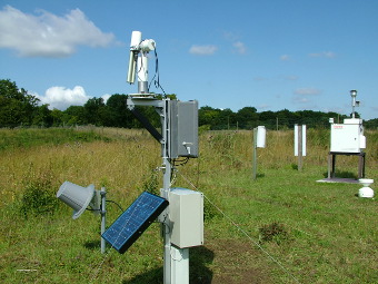
1 - View of the sunphotometer. |
| Image
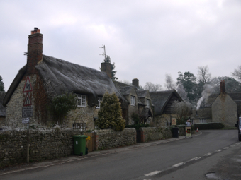
2 - Village of Wytham, Oxford |
|
Image 1
|
Image 2
|
|
|
Site Coordinates and Elevation:
|
- Latitude: 51.77028° North
- Longitude: 1.33250° West
- Elevation: 160.0 Meters
|
|
Site
Description:
|
- The site is located 5km north-west of the city of Oxford, on a 10ha semi-natural grassland surrounded by woodland (Wytham Woods), within mainly an agricultural landscape with some urban areas. RAF Brize Norton is 16km west, with Wytham underneath the flight path. The Wytham Estate is owned by the University of Oxford and is part of the Environmental Change Network (http://www.ecn.ac.uk).�
|
|
Principal
Investigator(s)
Information:
|
- Charles George
- E-mail: ctg@ceh.ac.uk
Charles George
Centre for Ecology & Hydrology
Maclean Building
Benson Lane
Crowmarsh Gifford
Wallingford, OX10 8BB
Tel: ++44 1491 838800
Email: ctg@ceh.ac.uk
|
|
Site
Manager(s) Information:
|
- Denise Pallett
- Email: Wytham_ECN@ceh.ac.uk
-
Dr. Denise Pallett
Centre for Ecology and Hydrology
Maclean Building
Benson Lane
Crowmarsh Gifford
Wallingford, Oxfordshire. OX10 8BB
Tel: 01491692634
Email: Wytham_ECN@ceh.ac.uk
AND
- Stefanie Schafer
- Email: Wytham_ECN@ceh.ac.uk
-
Ms. Stefanie Schafer
Centre for Ecology and Hydrology
Maclean Building
Benson Lane
Crowmarsh Gifford
Wallingford, Oxfordshire. OX10 8BB
Tel: 01491692634
Email: Wytham_ECN@ceh.ac.uk
|
|
Responsible
Institution(s):
|
|
|
Email Amy Scully
for content and picture updates.
Last Generated: 10 MAY 2024
|