|
|
 |
AERONET Site Information Database
Wallops (Wallops Island, Virginia)
Site Index
|
|
|
Image
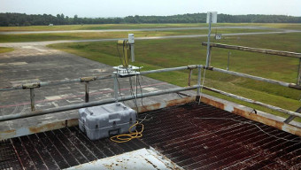
1 - View of the instrument. |
| Image
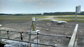
2 - View of the instrument. |
|
Image 1
|
Image 2
|
|
|
Site Coordinates and Elevation:
|
- Latitude: 37.93285° North
- Longitude: 75.47195° West
- Elevation: 37.0 Meters
|
|
Site
Description:
|
- The instrument is mounted on the platform of an old radar tower located on top of an aircraft hangar at the NASA GSFC Wallops Flight Facility. This site is situated ~2 km from Chincoteague Bay and ~15 km from the Atlantic Ocean to the east and ~25km from the Chesapeake Bay to the west. Agriculture activities are prominent along the Virginia Eastern Shore of the Delmarva peninsula.�**When accessing the tower for maintenance, stay on the metal grinding of the tower and stay off the wooden covers on the top level of the tower
|
|
Principal
Investigator(s)
Information:
|
- Pawan Gupta
- E-mail: pawan.gupta@nasa.gov
-
Pawan Gupta
NASA Goddard Space Flight Center
Code 618. Bldg.33. Rm.G412
Greenbelt, MD. 20771
Tel: 301-614-6658
Email: pawan.gupta@nasa.gov
- Elena Lind
- E-mail: elena.lind@nasa.gov
-
Elena Lind
NASA Goddard Space Flight Center
Code 618. Bldg.33. Rm.G414
Greenbelt, MD 20771
Tel: 301-614-6629
Email: elena.lind@nasa.gov
|
|
Site
Manager(s) Information:
|
- Jim Yungel
- Email: james.k.yungel@nasa.gov
-
Jim Yungel
Wallops Flight Facility
Bldg N-159, Room E203
Wallops Island, VA, 23337
Phone: 757-824-1060; Fax: 757-824-1036
E-mail: james.k.yungel@nasa.gov
AND
- Matt Linkswiler
- Email: Matthew.A.Linkswiler@nasa.gov
-
Matt Linkswiler
NASA / Wallops Flight Facility
Bldg N-159, Room E203
Wallops Island, VA 23337
Phone: 757-824-1020
Email: Matthew.A.Linkswiler@nasa.gov
|
|
Responsible
Institution(s):
|
|
|
Email Amy Scully
for content and picture updates.
Additional Photographs and Images
| CAPTION | IMAGE |
|---|
|
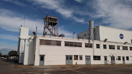
Image 3 - Old radar tower located on top of an aircraft hangar at the NASA GSFC Wallops Flight Facility
| 
|
Last Generated: 28 MAY 2024
|