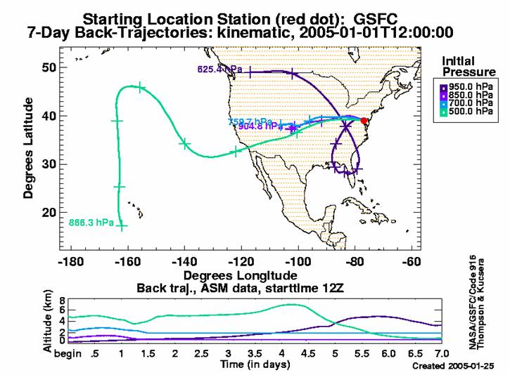
In 2002, NASA allotted funds through the Research, Education and Applications Solutions Network (REASoN) Comprehensive Agreement Notice (CAN) to attempt to improve data accessibility and analysis of NASA Earth Science data sets. This effort titled, "Back Trajectories, AERONET, MODIS, GOCART, and MPLNET Aerosol Synergism (BAMGOMAS)," proposed to provide aerosol ground-based (AERONET and MPLNET), satellite-based (MODIS), and model output (GOCART and Back trajectories) at one user-friendly web site for use by researchers, students, and the general public.
The AERONET Data Synergy Tool has continued to evolve with the incorporation of solar flux from the Solar Radiation Network (SolRad-Net) and ocean color from AERONET-Ocean Color ground-based networks. Furthermore, AQUA-MODIS, TERRA-MODIS, and SeaWiFS GIOVANNI satellite data have been linked to the Data Synergy Tool
+ Access the AERONET Data Synergy Tool
|